What is St’ART

St'ART is a platform specifically designed to support the Cultural Heritage Safeguard - through continuous monitoring services - and Site Management - through the provision of ancillary services.

St'ART is based on the concept of Site Knowledge Management, acquiring a set of heterogeneous data (by UAV, GPR, in situ sensors, satellites, historical studies, etc.) and, thus, constituting a complete and evolving information core of the site, interoperable with the Carta del Rischio system (ICR - MiC).

Among the ancillary services, St'ART includes the visitor flow analysis within the cultural geofenced areas. Visitors who authorise anonymous tracking, through the use of a dedicated mobile app, benefit from certified historical information, logistical and emergency notes, offering in return to the manager information on their movements in the area, from which to derive preferences, average dwell time, etc. (data analytics).

Who it is addressed to

St'ART is aimed at managers of cultural sites, Municipalities and all the Institutions responsible for the protection and enhancement of Cultural Heritage, as well as municipal administrations as support for monitoring the area under their jurisdiction.

In addition, as a Site Knowledge Hub, it is also aimed at Entities, Research Institutes and Universities as support for scientific studies carried out on the site.

St'ARTed sites

St'ART is, therefore, proposed as an advanced and evolutionary tool to support Safeguarding and Monitoring and Valorisation aspects, in line with the general strategies of the Ministry of Culture, operational standards and specific needs of the sites.

About St’ART

General features of the service

St'ART guarantees to the user a continuous accessibility to data available on the platform, managed in accordance with the privacy regulations in force.

The St'ART user is directly involved in the selection of the most suitable services and is involved in all the phases of activation.

Training courses are provided on the Carta del Rischio methodology and on the use of St'ART platform.


Also, a Customer Service is foreseen for assistance during the activation and operational maintenance of the service.
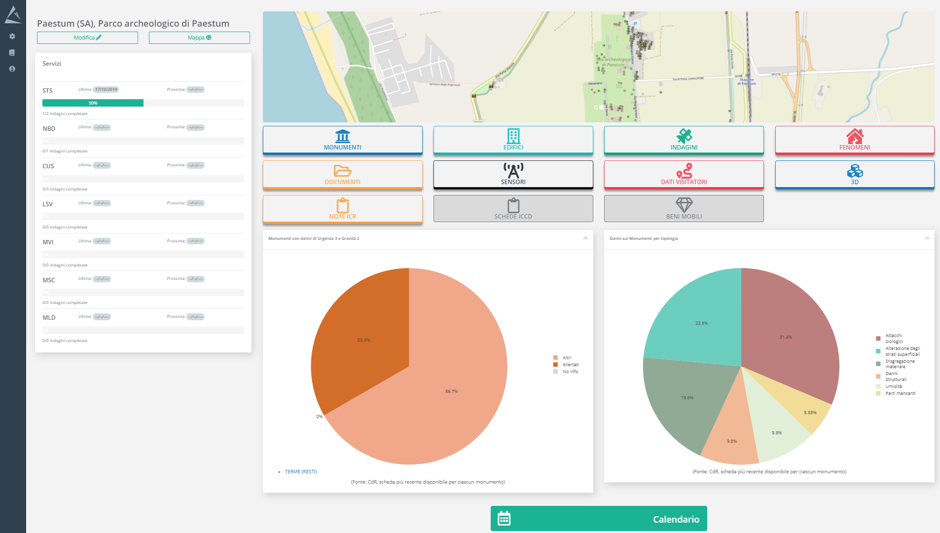
dashboard

Expected evolutions

St'ART is an evolutionary platform, capable of progressively adopting new components that technological evolution will make available, and new application services progressively as studies and experiments progress.


Further evolutions are being studied and developed, concerning:

 - impact of climate change, with respect to the concept of damage expressed by the Carta del Rischio,

 - completion of services derived from the criticalities linked to atmospheric pollution,

 - underwater archaeological sites

 - use of A.I. for data processing and progressive improvement of the services

Service portfolio

The criticalities of the site and the resulting services are catalogued on the basis of the methodology applicable to the Cultural Heritage domain.

Detection of ground deformations; the survey is aimed at monitoring the movements of the ground and of buildings and infrastructures located on it.
Detection of properties changes by comparing satellite images. The survey allows both the detection of new buildings and the monitoring of transformations, expansion and demolitions of existing buildings. As well as for surveillance and protection purposes, this service provides support for the integration and updating of official data, such as cadastral maps.
Detection of changes in land use by comparing two or more satellite images. The survey allows the detection of changes occurred in the territory, through the increase or reduction of anthropized surfaces and natural areas.
Calculation of the vegetation stress level derived by images acquired by satellite or drone according to the extent of the area of interest.
This service provides a survey aimed at detecting and mapping biological patinas and weed vegetation, through the analysis of images acquired by UAV.
This service provides an assessment of the state of conservation of roofs, mortars, etc. through images acquired by UAV.
Detection of instability phenomena through images acquired by UAV. The survey makes it possible to detect lesions (fractures and cracks) and deformations of structures or parts of structures that are difficult to access and to monitor their progress over time.
This service provides the updating or a new production of cartography of the built environment of historical centres, archaeological sites and widespread heritage, with perimeter and georeferencing of real estate and civil buildings.

St'ART platform has been developed thanks to needs directly expressed by users with respect to the specific type of archaeological sites.

St'ART is the joint result of business investments and national (ASI, POR, MiC) and international (ASI-ESA Business Application) public funding.

For information

Nextant Applications & Innovative Solutions S.r.l.
Via Andrea Noale, 345a
Roma, 00155, RM
Tel. +39 06 91139009

For information about the service,
send us an e-mail.
start.info@nais-solutions.it

Copyright © 2016 NAIS Srl
All rights reserved